Through rapid technological developments over the last few years, 3D LiDAR as well as high-resolution orthophoto techniques have become the most effective and efficient methods for capturing large amounts of geographic data.
We will work safely or not at all
01
What we do
Applications
- 3D Topographical Photogrammetry and Modelling Surveys
- Route surveys of Highways, Pipelines and OHLs.
- Floodplain and Coastline surveys
- Infrastructure Inspection surveys
- Construction site progress videos
40Seven advantage
- We use the latest and safest Drone equipment including the DJI M300 RTK
- We have full CAA qualified pilots operating under a UK CAA approved Operations Manual
- Drones deliver extremely fast and efficient collection of survey data
- We can survey areas with little or no access requirements
- The data can be processed and delivered quickly following capture
02
How we do it
An Orthophotomap is a seamless digital, map accurate vertical photograph of an area created from aerial photographs. They are created by taking high resolution aerial images and draping them over a Digital Terrain Model (DTM) using ERDAS IMAGE software to create perfectly true to scale aerial images. Each image is then mosaiced and colour balanced to provide a high quality map accurate photograph.
Where access or safety issues are important we are able to produce high accuracy topographical maps from aerial photographs when traditional survey methods are not possible. Photogrammetrically produced maps can also be very cost-effective for topographical mapping of large areas.
Using on board High-Resolution digital cameras makes a copter the ideal drone for carrying out inspection surveys of any had to reach structure. We can carry out inspection surveys on buildings, bridges, pylons, tanks and provide High-Resolution images and videos that can be viewed, zoomed and analysed to identify any structural issues or damage. This can include identifying roof damage on a church, corrosion on electricity pylons or developing cracks in high-rise buildings, the possibilities are endless.
Aerial LiDAR surveys utilise high-powered laser scanners carried on aircraft or helicopters to capture thousands of points every second and can cover hundreds of square Kilometres during each flight. Airborne LiDAR has a real advantage over terrestrial photogrammetry in that it can penetrate through vegetation and tree canopies to provide a complete model of the landscape. Where large areas of Topographical Survey data are required, Aerial LiDAR really is the most cost efficient way to acquire your Digital Terrain Model. High accuracy ground control is an absolute requirement to enable an accurate fix of your LiDAR data.
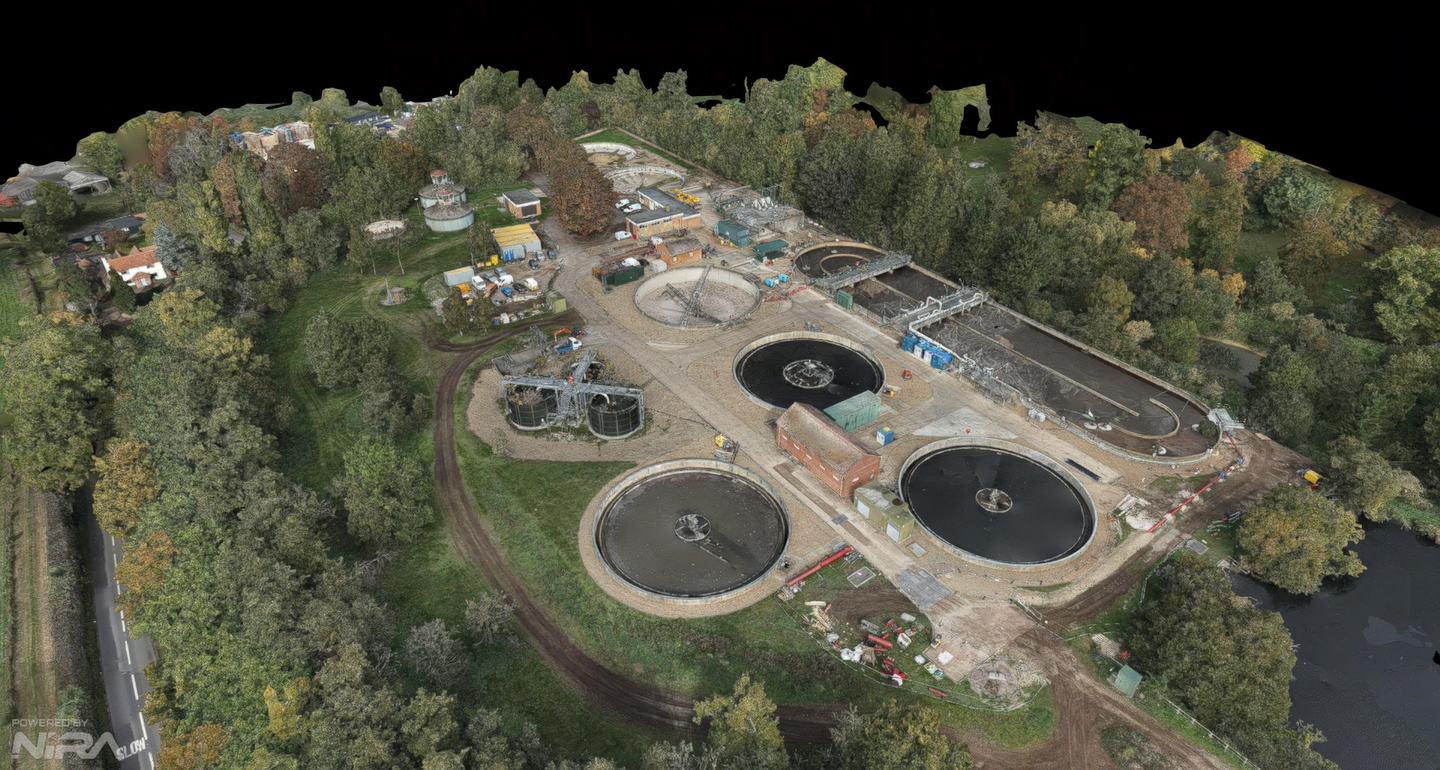
Example aerial image of Chesham STW
03
Why choose 40SEVEN?What sets 40SEVEN apart?
We pride ourselves on being able to deliver a high quality product and meeting clients delivery requirements without compromise by focusing on:-
- Quality – We have a robust and comprehensive Quality Assurance process and every project is subjected to our rigorous Quality Assessment system, which is performed by qualified and accredited professionals.
- Service – Our clients are allocated a dedicated Project Manager with proven industry experience. We pride ourselves on delivering one stop shop solutions and finding creative answers to the range of challenges projects undoubtedly throw up.
- Value – By utilizing the very latest technology and experienced surveyors based throughout the country, 40Seven provide cost efficient solutions for all our clients surveying needs.
40SEVEN Case StudiesHow we've helped our clients


