Laser scanning is transforming the way we collect data, enabling huge amounts of information to be gathered in the most congested and complicated environments. The latest BIM software enables architects and designers to visualise and build schemes in a virtual reality and the accuracy of survey information we provide is key to ensuring a fully costed and achievable project.
We will work safely or not at all
01
What we do40Seven utilise the latest technology and techniques to deliver the benefits of Laser Scanning to our clients.
Applications
- Waste Water Treatment Works, including pumping stations and wet wells
- Building internals to enable change of use designs and remodelling
- External elevations for facade restorations or rights of light calculations
- Electrical Substations and Pylons for refurbishment and extension projects
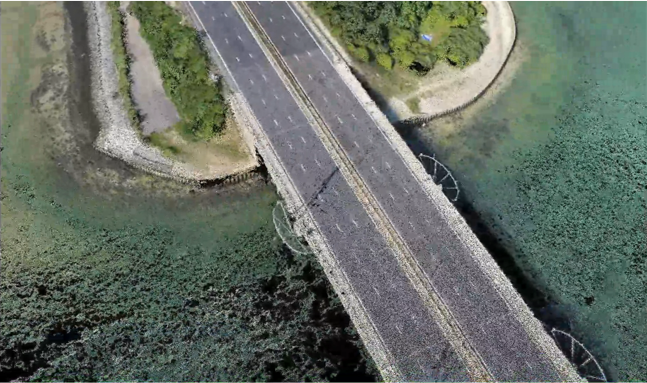
- Highway infrastructure to enable visualisation of redesigns and upgrades
40Seven advantage
- Rapid data capture using the latest technology – Faro S150 and Leica RTC360 Laser Scanners
- Data supplied in a variety of formats including 3D Revit, Raw Point Clouds and High Definition Photogrammetry
- Enables 3D Modelling in BIM applications including AutoCAD Revit
- High positional accuracy and Level of Detail (LOD) to suit client requirements
02
How we do itBy utilising the very latest technology and experienced surveyors based throughout the country
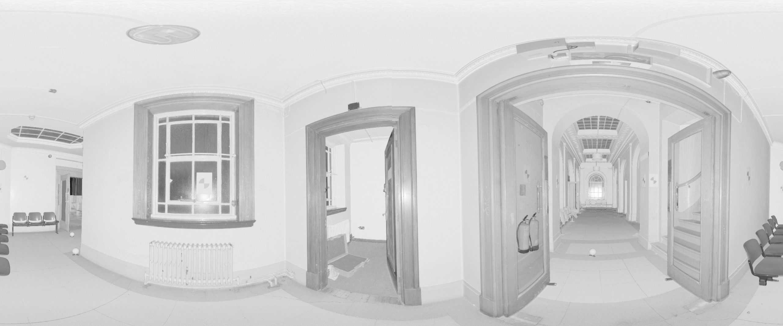
Point cloud surveys are captured using Laser Scanners to gather vast amounts of detailed information quickly and accurately. The gathered information can then be used to generate a BIM of the surveyed building or structure. The captured digital ‘Point Cloud’ information contains detail points of all the structures and features within a 360 degree view and this data can be used to generate the geometry of the building and the fixtures and fittings within it.
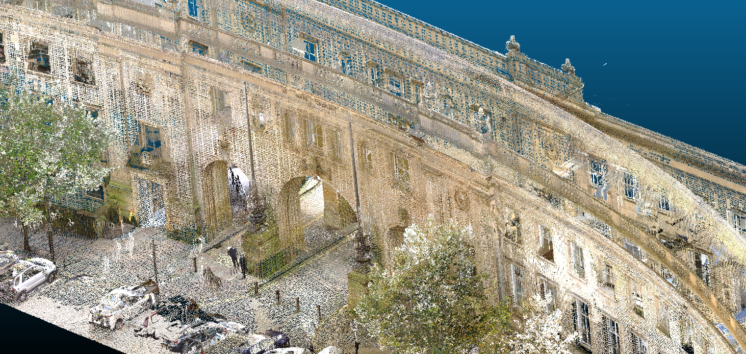
All of our Laser Scanners are equipped with in-built High-Definition cameras which are used to capture Hi-resolution images of each scan. These can be captured in colour or greyscale as seen below and create a permanent record of the building or sites structure and condition. They can be used to colourise the Point Cloud, prepare video walk-throughs and can also be used for condition assessment purposes.
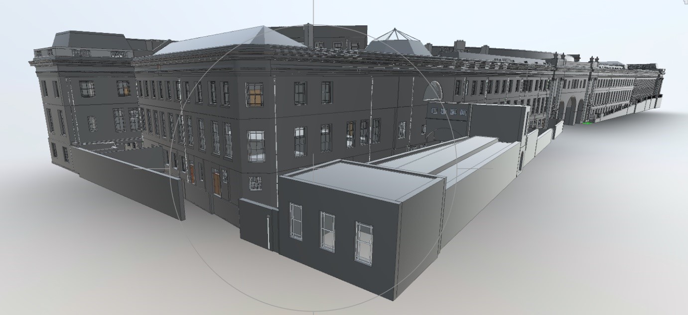
3D Models provide a graphical image or digital representation of a building or structure, providing the user with a clearer understanding of the project. This not only makes visualising the building easier, but also allows the user to make alterations and changes to the building and see how these will affect the building visually and structurally.
Mobile mapping is carried out by placing laser scanners on to a moving vehicle and driving around a site or along a highway to gather data which is then used to create a point cloud of the survey area. This technique is especially useful where lengths of highway require a topographical survey, but access is restricted by traffic permitting. Traffic Management can be expensive and causes disruption to the traffic network. Mobile Mapping removes the need for Traffic Management because the survey is performed at normal driving speeds and in a fraction of the time. The required detail, such as kerb lines and road furniture are then digitally extracted from the Point Cloud in an office environment to produce a 3D CAD drawing.
03
Why choose 40SEVEN?What sets 40SEVEN apart?
We pride ourselves on being able to deliver a high quality product and meeting clients delivery requirements without compromise by focusing on:-
- Quality – Every project we deliver is subject to our rigorous Quality Control process, which is managed by qualified and accredited professionals.
- Service – Our clients are allocated a dedicated Project Manager with proven industry experience. We pride ourselves on delivering one stop shop solutions and finding creative answers to the range of challenges projects undoubtedly throw up.
- Value – By utilizing the very latest technology and experienced surveyors based throughout the country, 40Seven provide cost efficient solutions for all our clients surveying needs.

40SEVEN Case StudiesHow we've helped our clients