We will work safely or not at all

01

Client requirements

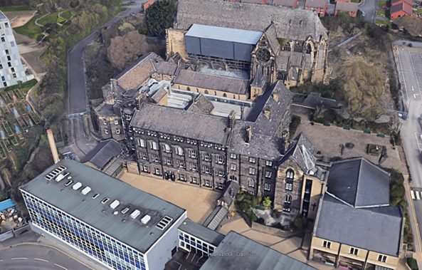
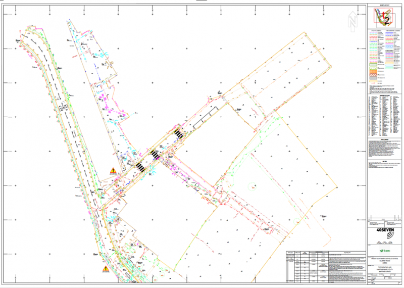
BAM Construction instructed 40SEVEN to complete a series of surveys of Mount St Mary’s Catholic School, in Leeds. The surveys were required to inform the renovation and refurbishment design process of the stone, Victorian building.

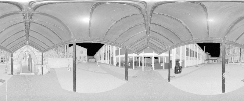
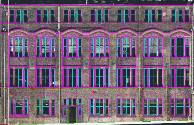
The primary requirement was to survey the building externals, including each elevation, the building roof plan and the inward-facing elevations within the roof plan.

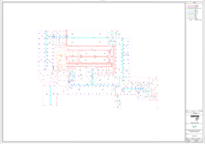
An additional requirement was to carry out a Topographical and Underground Utility Survey of the site, and adjacent highway, where alignment alterations are to be made.

02

40Seven Solution

We employed several surveying methods to collect and deliver accurate data to our client.

Firstly, Drone Surveying, to cover all areas of the four-floor, slate-roofed main building. The tight spaces around the building made it almost impossible to capture all the required detail using ground-based laser scanners. We also had the additional challenge of surveying the inward-facing elevations on the roof. The best way, therefore, to capture the roof detail and internally-facing elevations was to fly our drone over the building. The Drone Survey was completed in 1 hour.

Secondly, Laser Scanning. Our 3D Modelling team used tripod -mounted laser scanners to accurately survey all of the building elevations from the ground. The resulting PointClouds from the Laser Scanners and the Drone were then incorporated into a single model from which we could digitise the elevations and the roof plan. The Laser Scan Survey data was captured in 2 days.

Thirdly, Topographical and PAS128 Underground Utility Surveys to survey the wider site. Our team completed these in 4 days.

Martyn Utley
Business Development Manager
Contact 40Seven
03

The results

We combined all of the data collected from our various surveys to deliver a fully-comprehensive site survey to our client.

The resulting PointClouds from the Laser Scans and the Drone Survey were  incorporated into a single model, from which we ‘digitised’ the elevations and the roof plan. This black and white image shows a 360-degree scan of the processed photogrammetry of the West elevation:

The colour-mapped scans were flattened and ‘digitised’ within AutoCAD 3D to extract the elevations, and clearly show all of the required detailed elements our client needed to see; window and door openings, the window frames, rainwater pipes, gutters, and all surface-mounted features such as fire-alarms and exterior lighting.

West Elevation – Section of the Colourised Scan, showing digitization in progress.

Roof Plan – Final Deliverable

Combined Topographical & Underground Utility Survey – Final Deliverable

Explore Our Solutions

Industry-leading surveying services, delivering the right data at the right time.