Home > Case Studies > Airside surveying works at Manchester airport
01
Client requirements
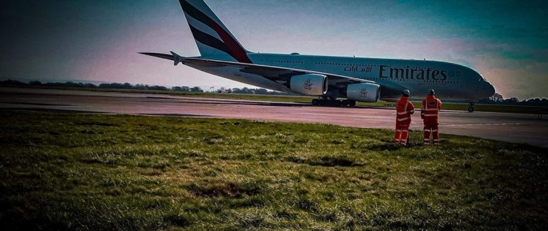
Bethell Construction instructed 40SEVEN to undertake Topographical and Underground Utility Surveys for Manchester airport, who are planning upgrades to the layout and infrastructure of the plane stands and taxiways – an area known as Juliet Echo.
Improvement work in the aviation industry were paused for two years, due to the pandemic, but are gradually getting back to normal.
02
40Seven Solution
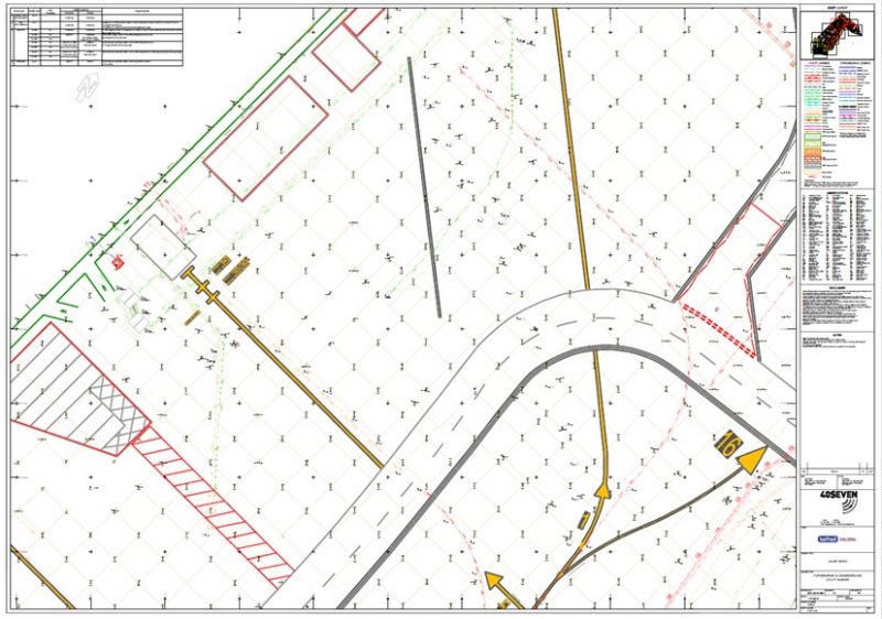
An area of over 4ha was surveyed in total to locate underground utilities, voids and anomalies, using electro-magnetic and ground-probing radar equipment, and all located items were surveyed, topographically, using Total Stations. A grid of levels was surveyed across the pavements to record all pad levels, joints, paint markings, service covers, ground lighting and changes of surface.
The survey was carried out with high precision – all survey points being tied into the Manchester Airport Grid and Datum.
The combined Topographical and Utility Survey was undertaken over three weeks, by a three person survey team, who worked only during daylight hours. Our team was escorted airside, with their vehicles and equipment, each day, which remained open to air traffic movements throughout the survey.
Despite some challenging weather, which impacted our work on site, the survey was carried out to the programmed timescale. Final drawings were supplied in 3D AutoCAD format, with an accompanying report that included full descriptions for the newly-installed control stations.
Industry-leading surveying services, delivering the right data at the right time.
We use cookies to ensure that we give you the best experience on our website. If you continue to use this site we will assume that you are happy with it.Ok