We have many 30 years+ experience carrying out Topographical & Underground Utility surveys for the water sector – and with the continued development and adoption of 3D Modelling techniques we are increasingly asked to carry out Laser Scan surveys to generate 3D Models of Water Treatment Works. We were asked to carry out one such survey of Armthorpe treatment works, to produce a 3d Model, for our client JN Bentley, on behalf of Severn Trent Water.
02
40Seven Solution
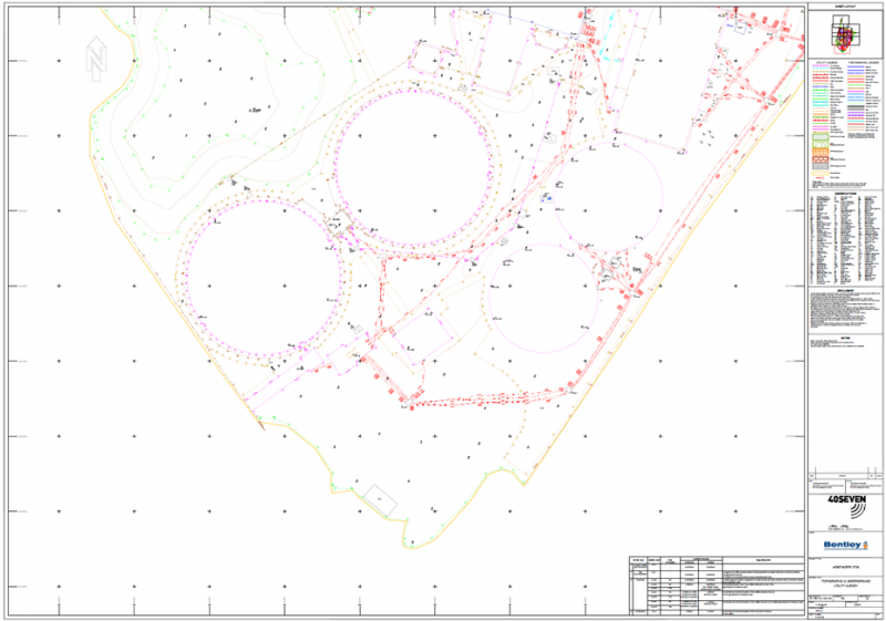
A combined Topographical and Underground Utility of the whole site was carried out over the 2-week Christmas holiday in December 2021, with a 3-person survey team.
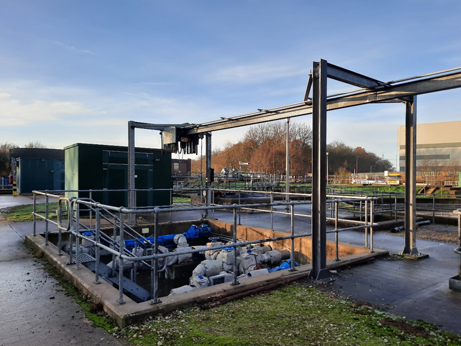
The site area measures approximately 1.77ha, and the survey was carried out to PAS128 M2 specification. The level of detail, and intensity of services on treatment works, makes the surveys particularly challenging, with accuracy paramount to ensure the hydraulics of the treatment plant work correctly.
All Topographical features and Underground Utilities were accurately surveyed, including items such as weir levels, pipe invert levels, pipe diameters and chamber dimensions. The Utility Survey was carried out using the latest technology, including RD8200 and Mala HDR Pro GPR units, and the Topographical Survey was carried out using Trimble S10 Total Stations and R10 GPS units.
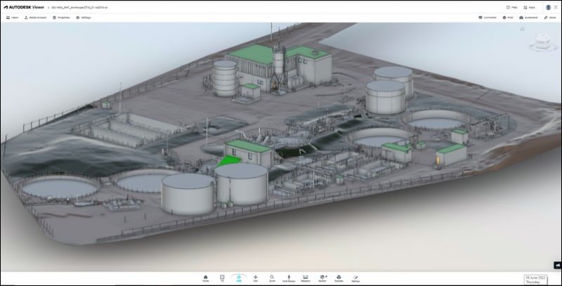
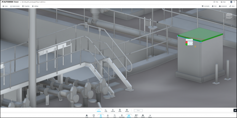
The Laser Scan Survey was carried out in January 2022, using a Faro S150 Laser Scanner to capture the point cloud and photogrammetry information. Ideally each feature to be modelled needs to be captured from multiple scan locations, so the surveyor worked around the site capturing close to a 100 over-lapping scans. The scans were captured and transferred to a site-based processing computer which enabled the scans to be registered whilst on site, reducing the office processing time required. The surveyor placed a combination of magnetic spheres and checker-board targets around the site to create a control network for the survey. This ensures that the scans are directly related to each other and ensures the resulting point cloud is accurate.
The Topographical and Underground Utility Survey was processed using our specialist survey software, and delivered in 3D AutoCAD format, shortly after completion on site. The Laser Scan survey was used to generate a fully coordinated Point Cloud drawing, before being transferred into AutoCAD Revit, in which our CAD team created a 3D Model to Level of Detail (LOD) 3.
The entire project ran to schedule, and resulted in highly detailed plans and models for our clients’ designers to work with.
Industry-leading surveying services, delivering the right data at the right time.
We use cookies to ensure that we give you the best experience on our website. If you continue to use this site we will assume that you are happy with it.Ok